What is a custom self-guided trail app?
A custom self-guided trail app is a location-aware mobile application (iOS and Android) that allows visitors to navigate outdoor, heritage, or cultural routes independently. Utilising GPS-triggered technology, these apps automatically deliver multimedia content, audio tours, and historical insights when a user reaches specific coordinates.
Preparing the right content for your intended audience, and testing it, is crucial for a successful self-guided tour that will be enjoyed by everyone.
How do I create a self-guided walking tour?
Creating a successful self-guided walking tour requires a mix of compelling local storytelling and reliable location-based technology. If you are a local council, heritage group, or tour operator looking to bring a trail to life, the creation process follows three main phases:
1. Route Planning & Waypoint Mapping
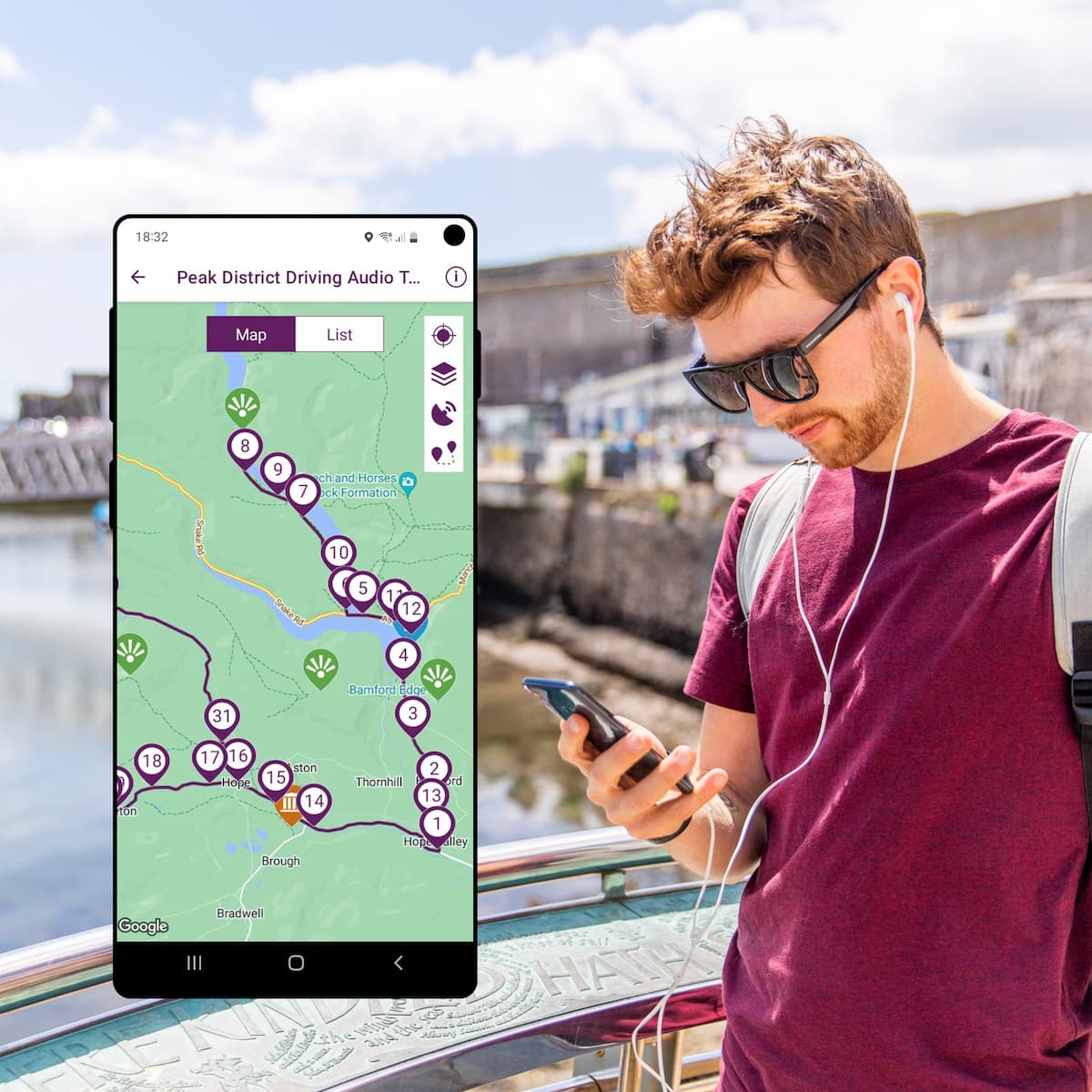
Plot your physical path, ensuring it is accessible and logically sequenced. Identify your key points of interest (waypoints)—the sweet spot is usually 10 to 15 stops for a 1-to-2-hour walk. Think carefully about how accessible the route is for the people you are aiming the tour at.
2. Multimedia Content Production
Gather the assets that will engage your visitors. This includes writing engaging text, collecting high-resolution contemporary and/or historical photos, and/or recording clear audio commentary. Think carefully about how accessible the content is for the people you are aiming the tour at.
3. The Technical Solution (The Smart Shortcut)
Building a GPS-mapped mobile app from scratch is expensive and complex. The most efficient way to deploy your tour is to use a specialist platform like the Places and Trails app platform.
It offers two seamless options to digitise your existing paper maps/PDF guides or brand new tour:
-
Your own branded app: AT Creative can build a fully bespoke, standalone mobile app tailored entirely to your branding, featuring interactive mapping, offline capability, and advanced analytics.
-
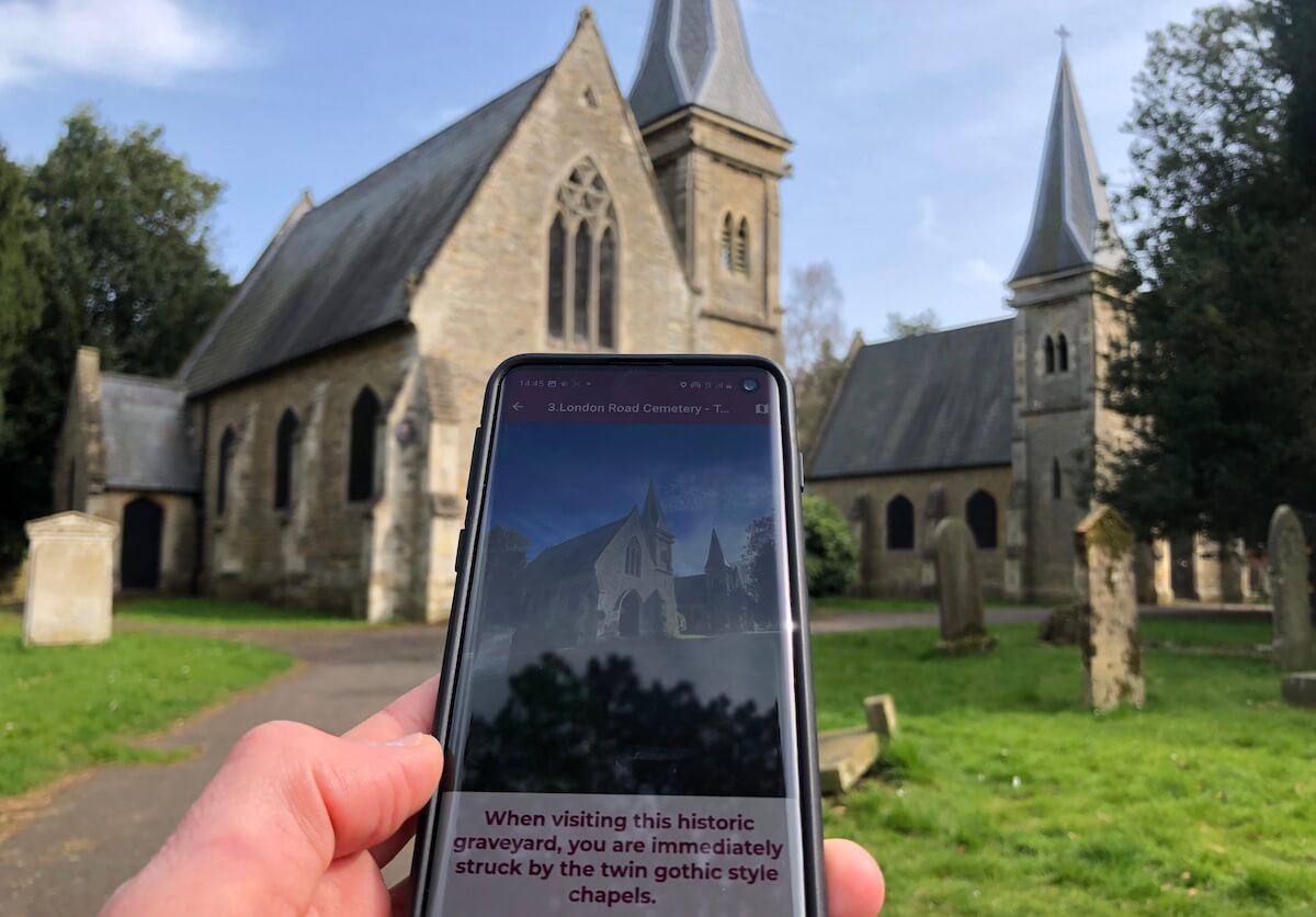
The Places and Trails app : If you want to avoid standalone setup and hosting costs, you can publish your route directly into their established Places and Trails app. This grants your trail immediate access to premium features like GPS auto-audio playback and Augmented Reality (AR) camera fades that show history layered over the modern streets.
Choosing the Right Trail App Publishing Model
| Feature | Standalone Native App | Shared App Platform (Places & Trails / ChurchExplorer) |
|---|---|---|
| Best For | Town/District Councils, National Park Authorities, Large Tourism Boards, Professional Tour Guides | Wildlife Trusts, Parish Churches, Parish/Community Councils, Smaller Budgets |
| App Store Presence | Independent listing under your brand name | Housed within an established app ecosystem |
| Setup Time | 2-6 months (requires app store approval) | 5-10 days (rapid deployment) |
| Key Advantage | Complete brand autonomy & custom analytics | Highly cost-effective with immediate audience access |
How do GPS-triggered tours work?
-
User downloads the trail: Visitors download the standalone app or open the route within the shared platform.
-
GPS tracking activates: The app uses background location services to track the user’s progress along a predefined path (no personal data is collected/stored).
-
Geofence trigger: When the visitor crosses a virtual boundary (geofence) around a point of interest, the app automatically wakes.
-
Multimedia delivery: The app plays high-quality audio narrations, reveals historic imagery, or triggers environmental sound effects without requiring user interaction.
Frequently Asked Questions for Councils and Heritage Organisations
-
Can trail apps work in remote areas without internet or mobile signal?
Yes, professional trail apps are designed to work completely offline. Visitors download the trail data and maps via Wi-Fi before they start. Once downloaded, the app uses the phone’s built-in GPS hardware to trigger audio and multimedia content, requiring zero data or network connection on the trail.
-
How do local authorities benefit from digital trail apps?
Local councils use trail apps to boost economic regeneration, disperse footfall to lesser-known areas, and capture precise user analytics. By tracking average dwell times and popular routes, tourism boards gain actionable data to optimise regional infrastructure and promote local hospitality businesses.
-
What is required to build a church or heritage tour app?
Building a tour app requires a map layout and historical assets (text, images, audio narration). AT Creative provides a feature-rich app platform alongside full-service production. We’ll prepare the mapping and can help you record professional audio, script content, and publish your tour(s) to the ChurchExplorer or Places and Trails app, or build your own self-guided trails app.